
Brashears topographic map
Click on the map to display elevation.
About this map
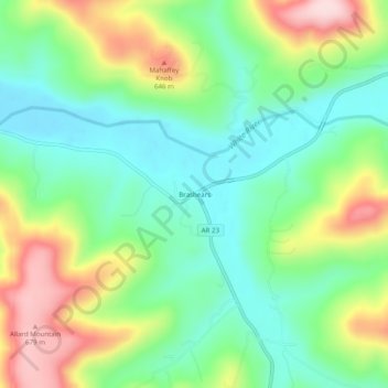
Name: Brashears topographic map, elevation, terrain.
Location: Brashears, Madison County, Arkansas, 72721, United States (35.79175 -93.81575 35.83175 -93.77575)
Average elevation: 1,729 ft
Minimum elevation: 1,411 ft
Maximum elevation: 2,297 ft
Madison County trails, hiking, mountain biking, running and outdoor activities