
Thank you for supporting this site ❤️
Make a donation
Make a donation
Gear up for your next adventure:
As an Amazon Associate, this site earns from qualifying purchases at no extra cost to you.
Cavalo topographic map
Click on the map to display elevation.
Thank you for supporting this site ❤️
Make a donation
Make a donation
Gear up for your next adventure:
As an Amazon Associate, this site earns from qualifying purchases at no extra cost to you.
About this map
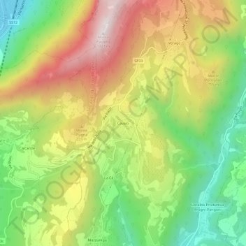
Name: Cavalo topographic map, elevation, terrain.
Location: Cavalo, Fumane, Verona, Veneto, 37022, Italia (45.54981 10.85105 45.58981 10.89105)
Average elevation: 1,847 ft
Minimum elevation: 302 ft
Maximum elevation: 3,655 ft
Thank you for supporting this site ❤️
Make a donation
Make a donation
Gear up for your next adventure:
As an Amazon Associate, this site earns from qualifying purchases at no extra cost to you.