Geolocate

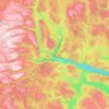
Groven topographic map

Click on the map to display elevation.

About this map

Name: Groven topographic map, elevation, terrain.

Location: Groven, Seljord, Telemark, 3844, Norway (59.62833 8.34268 59.66833 8.38268)

Average elevation: 2,552 ft

Minimum elevation: 1,608 ft

Maximum elevation: 3,691 ft

Other topographic maps

Click on a map to view its topography, its elevation and its terrain.

Porsgrunn

Norway > Telemark

Average elevation: 285 ft

Kragerø

Norway > Telemark

Average elevation: 154 ft

Drangedal

Norway > Telemark

Average elevation: 1,050 ft

Vinje

Norway > Telemark

Average elevation: 3,629 ft

Nissedal

Norway > Telemark

Average elevation: 1,640 ft

Seljord

Norway > Telemark

Average elevation: 2,362 ft

Notodden

Norway > Telemark

Notodden has a humid continental climate (Dfb), with cold winters and mild summers. Situated inland at low altitude in the Telemark region, it is one of the warmer towns in Norway during summer. The weather station at Notodden Airport has been recording since March 1970 (temperature and wind speed).…

Average elevation: 1,814 ft
Tokke

Norway > Telemark

Average elevation: 2,671 ft

Hjartdal

Norway > Telemark

Average elevation: 2,612 ft

Bordalsvatn

Norway > Telemark

Average elevation: 3,337 ft

Seljord

Norway > Telemark

Average elevation: 2,362 ft

Skien

Norway > Telemark

Average elevation: 784 ft

Sandane

Norway > Telemark

Average elevation: 2,051 ft

Store Såstein

Norway > Telemark

Average elevation: 10 ft

Gear up for your next adventure:

🔥Camping Stove - Portable stove for camping and backcountry cooking
🛶Inflatable Kayak - Portable kayak for rivers, lakes, and expeditions
🔥Plasma Lighters - Windproof lighters that work in any weather condition
📡GPS Antenna Upgrade - Enhance GPS reception in remote terrain
🧤Tactile Hiking Gloves - Keep hands warm while operating GPS and smartphone screens

As an Amazon Associate, this site earns from qualifying purchases at no extra cost to you.