Geolocate

Hammond topographic map

Click on the map to display elevation.

About this map

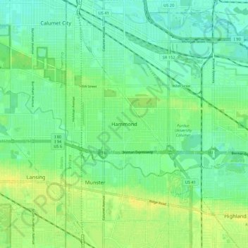
Name: Hammond topographic map, elevation, terrain.

Location: Hammond, Lake County, Indiana, 46324, United States (41.54337 -87.54004 41.62337 -87.46004)

Average elevation: 604 ft

Minimum elevation: 577 ft

Maximum elevation: 636 ft

Lake County trails, hiking, mountain biking, running and outdoor activities

Gear up for your next adventure:

🧼Biodegradable Camping Soap - Eco‑friendly soap for outdoor hygiene
🔦LED Headlamp - Bright and durable LED headlamp for night navigation
🎒Waterproof Dry Bags - Keep your electronics and maps dry inside your pack
❄️Traction Cleats - Prevent slips on icy trails during winter hikes
🌲Outdoor Survival Books - Best books on survival skills

As an Amazon Associate, this site earns from qualifying purchases at no extra cost to you.