
Thank you for supporting this site ❤️
Make a donation
Make a donation
Gear up for your next adventure:
As an Amazon Associate, this site earns from qualifying purchases at no extra cost to you.
Alins topographic map
Click on the map to display elevation.
Thank you for supporting this site ❤️
Make a donation
Make a donation
Gear up for your next adventure:
As an Amazon Associate, this site earns from qualifying purchases at no extra cost to you.
About this map
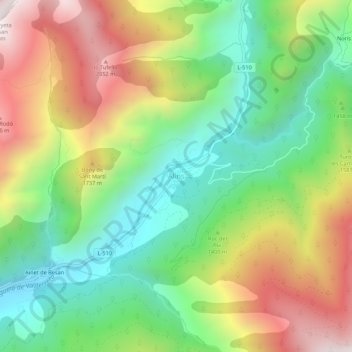
Name: Alins topographic map, elevation, terrain.
Location: Alins, Pallars Sobirá, Lérida, Cataluña, España (42.52912 1.29806 42.56912 1.33806)
Average elevation: 4,806 ft
Minimum elevation: 3,222 ft
Maximum elevation: 7,044 ft
Thank you for supporting this site ❤️
Make a donation
Make a donation
Gear up for your next adventure:
As an Amazon Associate, this site earns from qualifying purchases at no extra cost to you.