Geolocate

Custer Lookout topographic map

Click on the map to display elevation.

About this map

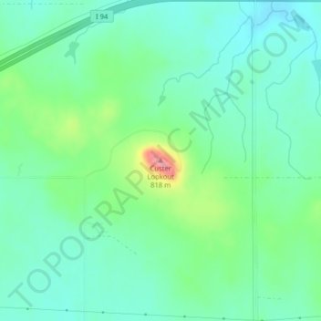
Name: Custer Lookout topographic map, elevation, terrain.

Location: Custer Lookout, Stark County, North Dakota, United States (46.84940 -102.17161 46.84950 -102.17151)

Average elevation: 2,448 ft

Minimum elevation: 2,352 ft

Maximum elevation: 2,703 ft

Stark County trails, hiking, mountain biking, running and outdoor activities

Other topographic maps

Click on a map to view its topography, its elevation and its terrain.

Dickinson

United States > North Dakota > Stark County

Average elevation: 2,461 ft

Gladstone

United States > North Dakota > Stark County

Average elevation: 2,372 ft

Gear up for your next adventure:

🏕️Family Camping Gear - Essentials for group camping trips
🚪Portable Camp Chair - Foldable chair for comfort at camp
🥇GPS Hiking Watch - Multi‑sport GPS watch with navigation and trail tracking
🖼️Topo Map Wall Art - Decorative topographic prints of famous peaks and regions
🔪Outdoor Multitools - Essential survival tools for gear repair and field use

As an Amazon Associate, this site earns from qualifying purchases at no extra cost to you.