
Steinhatchee topographic map
Click on the map to display elevation.
About this map
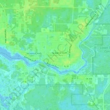
Name: Steinhatchee topographic map, elevation, terrain.
Location: Steinhatchee, Taylor County, Florida, 32359, United States (29.65208 -83.39586 29.69208 -83.35586)
Average elevation: 20 ft
Minimum elevation: -3 ft
Maximum elevation: 46 ft
Taylor County trails, hiking, mountain biking, running and outdoor activities
Other topographic maps
Click on a map to view its topography, its elevation and its terrain.
Big Bend Wildlife Management Area
United States > Florida > Taylor County > Steinhatchee
Average elevation: 20 ft