
Thank you for supporting this site ❤️
Make a donation
Make a donation
Gear up for your next adventure:
As an Amazon Associate, this site earns from qualifying purchases at no extra cost to you.
Gualda topographic map
Click on the map to display elevation.
Thank you for supporting this site ❤️
Make a donation
Make a donation
Gear up for your next adventure:
As an Amazon Associate, this site earns from qualifying purchases at no extra cost to you.
About this map
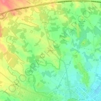
Name: Gualda topographic map, elevation, terrain.
Location: Gualda, Lleida, Segrià, Lleida, Catalonia, 25196, Spain (41.62456 0.59223 41.66456 0.63223)
Average elevation: 604 ft
Minimum elevation: 502 ft
Maximum elevation: 735 ft
Thank you for supporting this site ❤️
Make a donation
Make a donation
Gear up for your next adventure:
As an Amazon Associate, this site earns from qualifying purchases at no extra cost to you.