
Thank you for supporting this site ❤️
Make a donation
Make a donation
Gear up for your next adventure:
As an Amazon Associate, this site earns from qualifying purchases at no extra cost to you.
Ciarena topographic map
Click on the map to display elevation.
Thank you for supporting this site ❤️
Make a donation
Make a donation
Gear up for your next adventure:
As an Amazon Associate, this site earns from qualifying purchases at no extra cost to you.
About this map
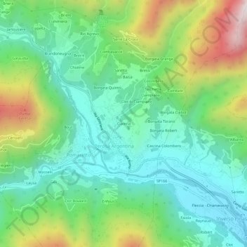
Name: Ciarena topographic map, elevation, terrain.
Location: Ciarena, Perosa Argentina, Torino, Piemonte, 10063, Italia (44.94106 7.17314 44.98106 7.21314)
Average elevation: 2,726 ft
Minimum elevation: 1,765 ft
Maximum elevation: 4,849 ft
Thank you for supporting this site ❤️
Make a donation
Make a donation
Gear up for your next adventure:
As an Amazon Associate, this site earns from qualifying purchases at no extra cost to you.