
South Stormont topographic map
Interactive map
Click on the map to display elevation.
About this map
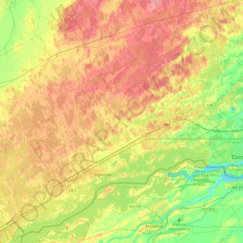
Name: South Stormont topographic map, elevation, terrain.
Average elevation: 266 ft
Minimum elevation: 144 ft
Maximum elevation: 377 ft
Other topographic maps
Click on a map to view its topography, its elevation and its terrain.
Lunenburg
Canada > Ontario > Stormont, Dundas and Glengarry Counties > South Stormont
Lunenburg, South Stormont, Stormont, Dundas and Glengarry Counties, Eastern Ontario, Ontario, K0C 1R0, Canada
Average elevation: 272 ft