Geolocate

Detmold topographic map

Click on the map to display elevation.

About this map
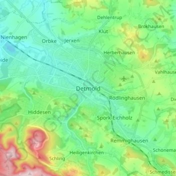
Name: Detmold topographic map, elevation, terrain.

Location: Detmold, Kreis Lippe, Noordrijn-Westfalen, 32756, Duitsland (51.89628 8.83915 51.97628 8.91915)

Average elevation: 600 ft

Minimum elevation: 344 ft

Maximum elevation: 1,316 ft

Gear up for your next adventure:

🧺Microfiber Travel Towels - Compact and fast-drying towels for trail use
📚USA Hiking Guide Books - Top trail guides and map books
🧭Hiking Compass - Precision compass for reliable navigation in the wilderness
🥾Women's Hiking Boots - Top-rated trail boots with ankle support and superior grip
🕶️GPS Smartphone Mount - Secure mount for phone navigation

As an Amazon Associate, this site earns from qualifying purchases at no extra cost to you.