
Make a donation
Gear up for your next adventure:
As an Amazon Associate, this site earns from qualifying purchases at no extra cost to you.
Bühren topographic map
Click on the map to display elevation.
Make a donation
Gear up for your next adventure:
As an Amazon Associate, this site earns from qualifying purchases at no extra cost to you.
About this map
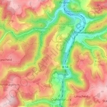
Name: Bühren topographic map, elevation, terrain.
Average elevation: 984 ft
Minimum elevation: 548 ft
Maximum elevation: 1,332 ft
Make a donation
Gear up for your next adventure:
As an Amazon Associate, this site earns from qualifying purchases at no extra cost to you.
Other topographic maps
Click on a map to view its topography, its elevation and its terrain.
Glörtalsperre
Deutschland > Nordrhein-Westfalen > Ennepe-Ruhr-Kreis > Breckerfeld > Loh
Die Staumauer, eine gekrümmte Gewichtsstaumauer aus Bruchsteinmauerwerk, hat eine Länge von 168 m und eine Höhe von 32 m. Die wasserbedeckte Fläche beträgt 21 ha, der Stauinhalt 2,1 Mio. m³ Wasser. Die Staumauer wurde in den Jahren 2000 bis 2003 saniert. Das Wasser war dabei abgelassen. Sie bekam einen…
Average elevation: 1,168 ft
Ennepetalsperre
Deutschland > Nordrhein-Westfalen > Ennepe-Ruhr-Kreis > Breckerfeld > Holthausen
Average elevation: 1,112 ft