
Thank you for supporting this site ❤️
Make a donation
Make a donation
Gear up for your next adventure:
As an Amazon Associate, this site earns from qualifying purchases at no extra cost to you.
Gol-Weyn topographic map
Click on the map to display elevation.
Thank you for supporting this site ❤️
Make a donation
Make a donation
Gear up for your next adventure:
As an Amazon Associate, this site earns from qualifying purchases at no extra cost to you.
About this map
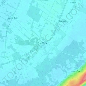
Name: Gol-Weyn topographic map, elevation, terrain.
Location: Gol-Weyn, Merca District, Lower Shabelle, South West, Somalia (1.61827 44.54040 1.69827 44.62040)
Average elevation: 226 ft
Minimum elevation: 207 ft
Maximum elevation: 492 ft
Thank you for supporting this site ❤️
Make a donation
Make a donation
Gear up for your next adventure:
As an Amazon Associate, this site earns from qualifying purchases at no extra cost to you.