
Thank you for supporting this site ❤️
Make a donation
Make a donation
Gear up for your next adventure:
As an Amazon Associate, this site earns from qualifying purchases at no extra cost to you.
Xuchitlán topographic map
Click on the map to display elevation.
Thank you for supporting this site ❤️
Make a donation
Make a donation
Gear up for your next adventure:
As an Amazon Associate, this site earns from qualifying purchases at no extra cost to you.
About this map
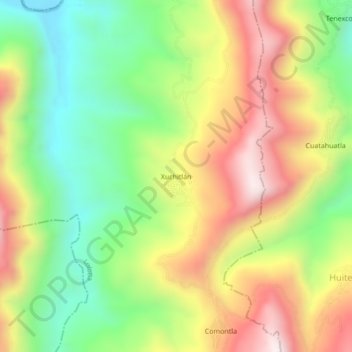
Name: Xuchitlán topographic map, elevation, terrain.
Location: Xuchitlán, Lolotla, Hidalgo, México (21.04507 -98.76435 21.08507 -98.72435)
Average elevation: 1,932 ft
Minimum elevation: 755 ft
Maximum elevation: 3,327 ft
Thank you for supporting this site ❤️
Make a donation
Make a donation
Gear up for your next adventure:
As an Amazon Associate, this site earns from qualifying purchases at no extra cost to you.