
Thank you for supporting this site ❤️
Make a donation
Make a donation
Gear up for your next adventure:
As an Amazon Associate, this site earns from qualifying purchases at no extra cost to you.
Weiz topographic map
Click on the map to display elevation.
Thank you for supporting this site ❤️
Make a donation
Make a donation
Gear up for your next adventure:
As an Amazon Associate, this site earns from qualifying purchases at no extra cost to you.
About this map
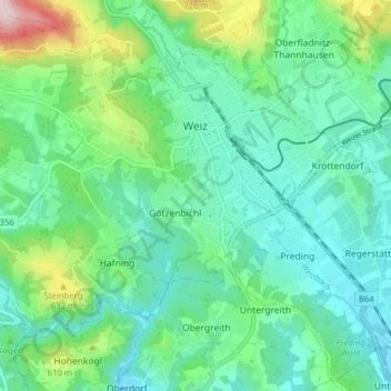
Name: Weiz topographic map, elevation, terrain.
Location: Weiz, Bezirk Weiz, Styrie, 8160, Autriche (47.18243 15.60417 47.23331 15.68263)
Average elevation: 1,657 ft
Minimum elevation: 1,342 ft
Maximum elevation: 2,684 ft
Thank you for supporting this site ❤️
Make a donation
Make a donation
Gear up for your next adventure:
As an Amazon Associate, this site earns from qualifying purchases at no extra cost to you.