
Thank you for supporting this site ❤️
Make a donation
Make a donation
Gear up for your next adventure:
As an Amazon Associate, this site earns from qualifying purchases at no extra cost to you.
Östanå topographic map
Click on the map to display elevation.
Thank you for supporting this site ❤️
Make a donation
Make a donation
Gear up for your next adventure:
As an Amazon Associate, this site earns from qualifying purchases at no extra cost to you.
About this map
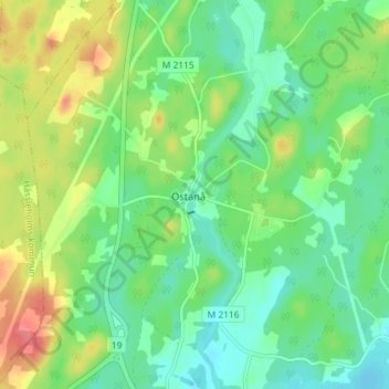
Name: Östanå topographic map, elevation, terrain.
Location: Östanå, Östra Göinge kommun, Skåne County, Sweden (56.28638 14.00057 56.32638 14.04057)
Average elevation: 220 ft
Minimum elevation: 144 ft
Maximum elevation: 358 ft
Thank you for supporting this site ❤️
Make a donation
Make a donation
Gear up for your next adventure:
As an Amazon Associate, this site earns from qualifying purchases at no extra cost to you.