
Thank you for supporting this site ❤️
Make a donation
Make a donation
Gear up for your next adventure:
As an Amazon Associate, this site earns from qualifying purchases at no extra cost to you.
Floridatown topographic map
Click on the map to display elevation.
Thank you for supporting this site ❤️
Make a donation
Make a donation
Gear up for your next adventure:
As an Amazon Associate, this site earns from qualifying purchases at no extra cost to you.
About this map
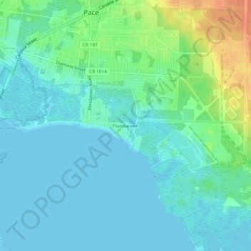
Name: Floridatown topographic map, elevation, terrain.
Location: Floridatown, Pace, Santa Rosa County, Florida, United States (30.56131 -87.17469 30.60131 -87.13469)
Average elevation: 33 ft
Minimum elevation: -13 ft
Maximum elevation: 141 ft
Santa Rosa County trails, hiking, mountain biking, running and outdoor activities
Thank you for supporting this site ❤️
Make a donation
Make a donation
Gear up for your next adventure:
As an Amazon Associate, this site earns from qualifying purchases at no extra cost to you.