Geolocate

Foods topographic map

Click on the map to display elevation.

About this map

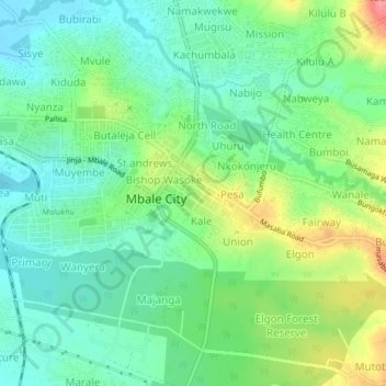
Name: Foods topographic map, elevation, terrain.

Location: Foods, Mbale City, Bugisa sub-region, Eastern Region, Uganda (1.05175 34.15878 1.09175 34.19878)

Average elevation: 3,717 ft

Minimum elevation: 3,625 ft

Maximum elevation: 3,894 ft

Gear up for your next adventure:

🧴Hand Sanitizer - Keep hands clean while hiking
👓Polarized Sunglasses - Outdoor sunglasses for glare reduction
🧭Map Reading Tools - Tools and kits for map navigation
🗺️NatGeo Topo Maps - High-quality waterproof printed topographic maps of US Parks
😴Insulated Sleeping Pads - Compact and warm pads for high-elevation camping

As an Amazon Associate, this site earns from qualifying purchases at no extra cost to you.