Geolocate

Lancaster topographic map

Click on the map to display elevation.

About this map

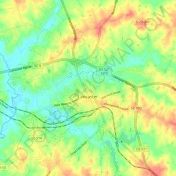
Name: Lancaster topographic map, elevation, terrain.

Location: Lancaster, Lancaster County, South Carolina, United States (34.68702 -80.81205 34.76100 -80.74579)

Average elevation: 512 ft

Minimum elevation: 430 ft

Maximum elevation: 607 ft

Other topographic maps

Click on a map to view its topography, its elevation and its terrain.

Gear up for your next adventure:

🪄Magnetic Compass - Accurate compass for navigation
🧭Compass with Lanyard - Easy‑carry compass for navigation
🥇GPS Hiking Watch - Multi‑sport GPS watch with navigation and trail tracking
🧷Carabiner Set - Durable clips for gear attachment
🧴Hand Sanitizer - Keep hands clean while hiking

As an Amazon Associate, this site earns from qualifying purchases at no extra cost to you.