
Thank you for supporting this site ❤️
Make a donation
Make a donation
Gear up for your next adventure:
As an Amazon Associate, this site earns from qualifying purchases at no extra cost to you.
Acciaroli topographic map
Click on the map to display elevation.
Thank you for supporting this site ❤️
Make a donation
Make a donation
Gear up for your next adventure:
As an Amazon Associate, this site earns from qualifying purchases at no extra cost to you.
About this map
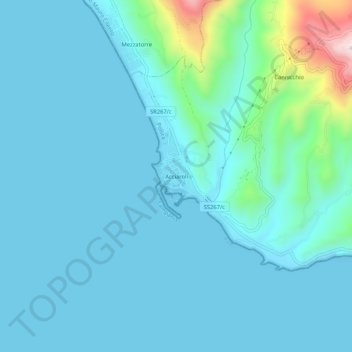
Name: Acciaroli topographic map, elevation, terrain.
Location: Acciaroli, Pollica, Salerno, Campania, 84068, Italia (40.16007 15.00706 40.20007 15.04706)
Average elevation: 194 ft
Minimum elevation: 0 ft
Maximum elevation: 1,562 ft
Thank you for supporting this site ❤️
Make a donation
Make a donation
Gear up for your next adventure:
As an Amazon Associate, this site earns from qualifying purchases at no extra cost to you.