Geolocate

Renner topographic map

Click on the map to display elevation.

About this map

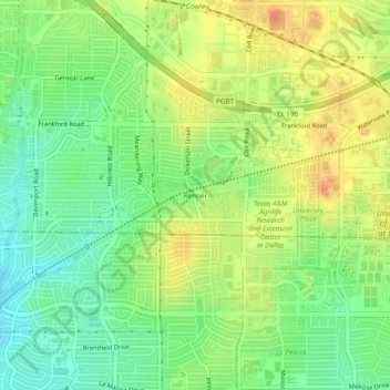
Name: Renner topographic map, elevation, terrain.

Location: Renner, Dallas, Collin County, Texas, 75252, United States (32.97040 -96.79417 33.01040 -96.75417)

Average elevation: 676 ft

Minimum elevation: 607 ft

Maximum elevation: 748 ft

Collin County trails, hiking, mountain biking, running and outdoor activities

Gear up for your next adventure:

🎒Trekking Poles - Sturdy poles for balance and stability on rough terrain
🥾Men's Hiking Boots - Durable, waterproof footwear for rugged terrain and steep inclines
🧥Men's Rain Shells - Premium waterproof and breathable jackets for mountain weather
🔌Solar Panel Charger - Charge gear sustainably outdoors
🧥Waterproof Jacket for Hiking - Breathable and rugged rain jacket for outdoor excursions

As an Amazon Associate, this site earns from qualifying purchases at no extra cost to you.