Geolocate

Phillack topographic map

Click on the map to display elevation.

About this map

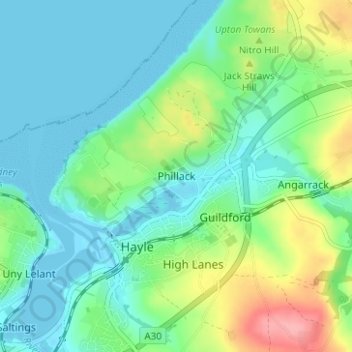
Name: Phillack topographic map, elevation, terrain.

Location: Phillack, Hayle, Cornwall, England, TR27 5AW, United Kingdom (50.17511 -5.43084 50.21511 -5.39084)

Average elevation: 89 ft

Minimum elevation: -10 ft

Maximum elevation: 328 ft

Gear up for your next adventure:

👖Convertible Hiking Pants - Versatile zip-off pants for changing altitudes and temperatures
📻Weather Alert Radios - Stay informed of storm risks while off-the-grid
🧤Hiking Gloves - Protective gloves for rugged trails
🧥Waterproof Jacket for Hiking - Breathable and rugged rain jacket for outdoor excursions
🔋Solar Power Banks - Keep your GPS and phone charged in remote wilderness areas

As an Amazon Associate, this site earns from qualifying purchases at no extra cost to you.