Geolocate

Ridge Farm topographic map

Click on the map to display elevation.

About this map

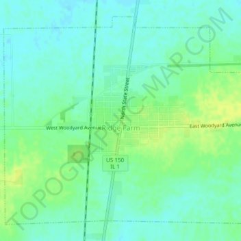
Name: Ridge Farm topographic map, elevation, terrain.

Location: Ridge Farm, Vermilion County, Illinois, United States (39.88405 -87.67017 39.90881 -87.63279)

Average elevation: 699 ft

Minimum elevation: 673 ft

Maximum elevation: 732 ft

Vermilion County trails, hiking, mountain biking, running and outdoor activities

Other topographic maps

Click on a map to view its topography, its elevation and its terrain.

Alvin

United States > Illinois > Vermilion County

Average elevation: 673 ft

Brooks Point

United States > Illinois > Vermilion County

Average elevation: 617 ft

Salt Fork

United States > Illinois > Vermilion County

Average elevation: 679 ft

Gear up for your next adventure:

🚗GPS Dash Cams - Record your scenic drives through mountain passes and canyons
🗃️Trail First Aid Kit - Essential kit for outdoor injuries and emergencies
🎒Day Hiking Backpack - Lightweight backpack perfect for day trips and outdoor adventures
🥘Titanium Cookware - Durable, featherlight pots and pans for backpacking
🧢Sun Protection Hats - Wide-brimmed and UPF-rated hats for high-altitude sun safety

As an Amazon Associate, this site earns from qualifying purchases at no extra cost to you.