Geolocate

Pawlett topographic map

Click on the map to display elevation.

About this map

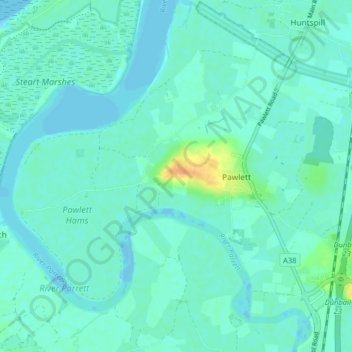
Name: Pawlett topographic map, elevation, terrain.

Location: Pawlett, Somerset, England, United Kingdom (51.16289 -3.05903 51.20090 -2.97844)

Average elevation: 20 ft

Minimum elevation: -26 ft

Maximum elevation: 112 ft

Gear up for your next adventure:

💧Water Filtration Bottles - Safely drink from streams and lakes while exploring
🧯Portable Fire Pit - Compact fire pit for camping spots
🌡️Handheld Weather Meters - Measure wind, temp, and pressure for safe mountain travel
🔥Plasma Lighters - Windproof lighters that work in any weather condition
🧦Hiking Socks - Comfortable socks to prevent blisters on long hikes

As an Amazon Associate, this site earns from qualifying purchases at no extra cost to you.