
Thank you for supporting this site ❤️
Make a donation
Make a donation
Gear up for your next adventure:
As an Amazon Associate, this site earns from qualifying purchases at no extra cost to you.
Suppirang topographic map
Click on the map to display elevation.
Thank you for supporting this site ❤️
Make a donation
Make a donation
Gear up for your next adventure:
As an Amazon Associate, this site earns from qualifying purchases at no extra cost to you.
About this map
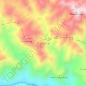
Name: Suppirang topographic map, elevation, terrain.
Location: Suppirang, Pinrang, South Sulawesi, Sulawesi, Indonesia (-3.31528 119.44988 -3.27528 119.48988)
Average elevation: 3,980 ft
Minimum elevation: 2,559 ft
Maximum elevation: 5,312 ft
Thank you for supporting this site ❤️
Make a donation
Make a donation
Gear up for your next adventure:
As an Amazon Associate, this site earns from qualifying purchases at no extra cost to you.
Other topographic maps
Click on a map to view its topography, its elevation and its terrain.