
Thank you for supporting this site ❤️
Make a donation
Make a donation
Gear up for your next adventure:
As an Amazon Associate, this site earns from qualifying purchases at no extra cost to you.
Strathan topographic map
Click on the map to display elevation.
Thank you for supporting this site ❤️
Make a donation
Make a donation
Gear up for your next adventure:
As an Amazon Associate, this site earns from qualifying purchases at no extra cost to you.
About this map
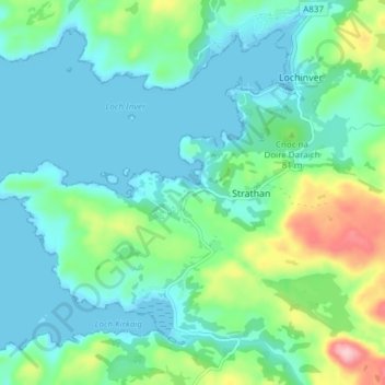
Name: Strathan topographic map, elevation, terrain.
Location: Strathan, Highland, Scotland, IV27 4LR, United Kingdom (58.11677 -5.28048 58.15677 -5.24048)
Average elevation: 138 ft
Minimum elevation: 0 ft
Maximum elevation: 617 ft
Thank you for supporting this site ❤️
Make a donation
Make a donation
Gear up for your next adventure:
As an Amazon Associate, this site earns from qualifying purchases at no extra cost to you.