Geolocate

Tekes topographic map

Click on the map to display elevation.

About this map

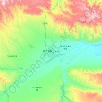
Name: Tekes topographic map, elevation, terrain.

Location: Tekes, Tekes County, Ili, Xinjiang, China (43.05690 81.67300 43.37690 81.99300)

Average elevation: 5,207 ft

Minimum elevation: 3,566 ft

Maximum elevation: 8,835 ft

Other topographic maps

Click on a map to view its topography, its elevation and its terrain.

Akekule Lake

China > Xinjiang > Tekes County

Average elevation: 10,564 ft

Gear up for your next adventure:

🧯Emergency Survival Kit - All‑in‑one survival essentials for the backcountry
🧭Pro Hiking Compasses - High-accuracy liquid-filled compasses for topographic orientation
🔌Solar Panel Charger - Charge gear sustainably outdoors
🩳Quick‑Dry Hiking Shorts - Comfortable and quick‑dry shorts for summer hiking
🧭GPS Watch Accessories - Bands and chargers for GPS watches

As an Amazon Associate, this site earns from qualifying purchases at no extra cost to you.