
Thank you for supporting this site ❤️
Make a donation
Make a donation
Gear up for your next adventure:
As an Amazon Associate, this site earns from qualifying purchases at no extra cost to you.
Courtételle topographic map
Click on the map to display elevation.
Thank you for supporting this site ❤️
Make a donation
Make a donation
Gear up for your next adventure:
As an Amazon Associate, this site earns from qualifying purchases at no extra cost to you.
About this map
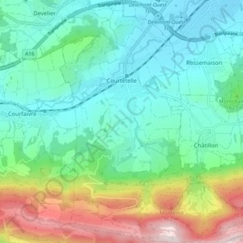
Name: Courtételle topographic map, elevation, terrain.
Location: Courtételle, District de Delémont, Jura, 2852, Switzerland (47.30588 7.29604 47.35961 7.33771)
Average elevation: 1,985 ft
Minimum elevation: 1,365 ft
Maximum elevation: 3,661 ft
Thank you for supporting this site ❤️
Make a donation
Make a donation
Gear up for your next adventure:
As an Amazon Associate, this site earns from qualifying purchases at no extra cost to you.