
Thank you for supporting this site ❤️
Make a donation
Make a donation
Gear up for your next adventure:
As an Amazon Associate, this site earns from qualifying purchases at no extra cost to you.
Bionzo topographic map
Click on the map to display elevation.
Thank you for supporting this site ❤️
Make a donation
Make a donation
Gear up for your next adventure:
As an Amazon Associate, this site earns from qualifying purchases at no extra cost to you.
About this map
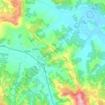
Name: Bionzo topographic map, elevation, terrain.
Location: Bionzo, Costigliole d'Asti, Asti, Piëmont, 14052, Italië (44.73905 8.19187 44.77905 8.23187)
Average elevation: 735 ft
Minimum elevation: 505 ft
Maximum elevation: 1,286 ft
Thank you for supporting this site ❤️
Make a donation
Make a donation
Gear up for your next adventure:
As an Amazon Associate, this site earns from qualifying purchases at no extra cost to you.