
Thank you for supporting this site ❤️
Make a donation
Make a donation
Gear up for your next adventure:
As an Amazon Associate, this site earns from qualifying purchases at no extra cost to you.
Belecke topographic map
Click on the map to display elevation.
Thank you for supporting this site ❤️
Make a donation
Make a donation
Gear up for your next adventure:
As an Amazon Associate, this site earns from qualifying purchases at no extra cost to you.
About this map
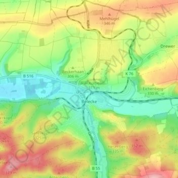
Name: Belecke topographic map, elevation, terrain.
Location: Belecke, Warstein, Kreis Soest, North Rhine-Westphalia, Germany (51.46486 8.30020 51.51370 8.37377)
Average elevation: 1,007 ft
Minimum elevation: 797 ft
Maximum elevation: 1,266 ft
Thank you for supporting this site ❤️
Make a donation
Make a donation
Gear up for your next adventure:
As an Amazon Associate, this site earns from qualifying purchases at no extra cost to you.