
Thank you for supporting this site ❤️
Make a donation
Make a donation
Gear up for your next adventure:
As an Amazon Associate, this site earns from qualifying purchases at no extra cost to you.
Aísa topographic map
Click on the map to display elevation.
Thank you for supporting this site ❤️
Make a donation
Make a donation
Gear up for your next adventure:
As an Amazon Associate, this site earns from qualifying purchases at no extra cost to you.
About this map
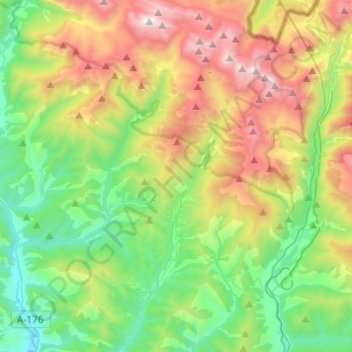
Name: Aísa topographic map, elevation, terrain.
Location: Aísa, Jacetania, Huesca, Aragon, 22889, Spain (42.61971 -0.68215 42.79923 -0.51265)
Average elevation: 4,491 ft
Minimum elevation: 2,231 ft
Maximum elevation: 8,658 ft
Thank you for supporting this site ❤️
Make a donation
Make a donation
Gear up for your next adventure:
As an Amazon Associate, this site earns from qualifying purchases at no extra cost to you.