Geolocate

Guibongan topographic map

Click on the map to display elevation.

About this map

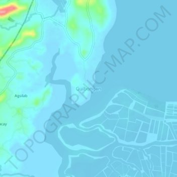
Name: Guibongan topographic map, elevation, terrain.

Location: Guibongan, Sapian, Capiz, Western Visayas, Philippines (11.49771 122.56252 11.53771 122.60252)

Average elevation: 20 ft

Minimum elevation: -13 ft

Maximum elevation: 344 ft

Gear up for your next adventure:

📌Outdoor GPS Map App - Apps and devices for digital topographic navigation
🧢Outdoor Hiking Hat - Sun protection hat for outdoor explorers
🏔️Mountain Trail Maps - High‑detail maps for popular peaks
🪓Survival Multi‑Tool - Versatile tool for camp and trail tasks
📱Solar Portable Charger - Solar power bank for charging devices off‑grid

As an Amazon Associate, this site earns from qualifying purchases at no extra cost to you.