Geolocate

Mwera topographic map

Click on the map to display elevation.

About this map

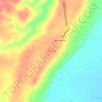
Name: Mwera topographic map, elevation, terrain.

Location: Mwera, Pangani, Tanga Region, Northern Zone, Tanzania (-5.50556 38.92963 -5.46556 38.96963)

Average elevation: 157 ft

Minimum elevation: 26 ft

Maximum elevation: 295 ft

Other topographic maps

Click on a map to view its topography, its elevation and its terrain.

Handeni

Tanzania > Tanga Region

Average elevation: 1,253 ft

Korogwe

Tanzania > Tanga Region

Average elevation: 2,451 ft

Gear up for your next adventure:

🩳Quick‑Dry Hiking Shorts - Comfortable and quick‑dry shorts for summer hiking
🗺️Topographic Maps - Detailed topo maps for hiking, exploring and outdoor navigation
🚗GPS Dash Cams - Record your scenic drives through mountain passes and canyons
👟Trail Running Shoes - Lightweight shoes for trail runners
🧴Hand Sanitizer - Keep hands clean while hiking

As an Amazon Associate, this site earns from qualifying purchases at no extra cost to you.