
Kugluktuk topographic map
Interactive map
Click on the map to display elevation.
About this map
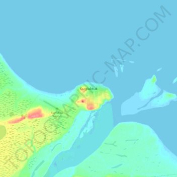
Name: Kugluktuk topographic map, elevation, terrain.
Location: Kugluktuk, Kitikmeot Region, Nunavut, X0B 0E0, Canada (67.78610 -115.14732 67.86610 -115.06732)
Average elevation: 23 ft
Minimum elevation: -13 ft
Maximum elevation: 213 ft