
Thank you for supporting this site ❤️
Make a donation
Make a donation
Gear up for your next adventure:
As an Amazon Associate, this site earns from qualifying purchases at no extra cost to you.
النامسي topographic map
Click on the map to display elevation.
Thank you for supporting this site ❤️
Make a donation
Make a donation
Gear up for your next adventure:
As an Amazon Associate, this site earns from qualifying purchases at no extra cost to you.
About this map
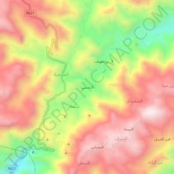
Name: النامسي topographic map, elevation, terrain.
Location: النامسي, سلفة, Yafa'a District, Lahij Governorate, Yemen (13.80380 45.24046 13.84380 45.28046)
Average elevation: 6,988 ft
Minimum elevation: 5,554 ft
Maximum elevation: 8,048 ft
Thank you for supporting this site ❤️
Make a donation
Make a donation
Gear up for your next adventure:
As an Amazon Associate, this site earns from qualifying purchases at no extra cost to you.