
临夏县 topographic map
Interactive map
Click on the map to display elevation.
About this map
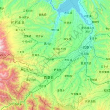
Name: 临夏县 topographic map, elevation, terrain.
Location: 临夏县, 临夏回族自治州 لٍشِا خُوِذُو ذِجِجِوْ, Gansu, China (35.34399 102.72355 35.80044 103.29485)
Average elevation: 7,454 ft
Minimum elevation: 5,663 ft
Maximum elevation: 13,051 ft
Other topographic maps
Click on a map to view its topography, its elevation and its terrain.
日宗
China > Gansu > 迭部县 ཐེ་བོ་རྫོང་།
日宗, 迭部县 ཐེ་བོ་རྫོང་།, 甘南藏族自治州 ཀན་ལྷོ་བོད་རིགས་རང་སྐྱོང་ཁུལ།, Gansu, China
Average elevation: 10,669 ft