Geolocate

Guinabang topographic map

Click on the map to display elevation.

About this map

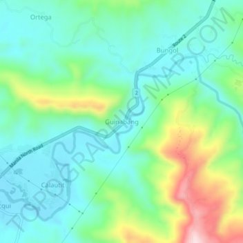
Name: Guinabang topographic map, elevation, terrain.

Location: Guinabang, La Union, Ilocos Region, 2520, Philippines (16.73920 120.37874 16.77920 120.41874)

Average elevation: 338 ft

Minimum elevation: 30 ft

Maximum elevation: 1,158 ft

Other topographic maps

Click on a map to view its topography, its elevation and its terrain.

Sudipen

Philippines > La Union

Average elevation: 315 ft

Caba

Philippines > La Union

Average elevation: 200 ft

Santo Tomas

Philippines > La Union

Average elevation: 194 ft

Gear up for your next adventure:

🎒Trail Energy Bars - High‑calorie bars for hiking energy
🚪Portable Camp Chair - Foldable chair for comfort at camp
🪑Ultralight Camp Chairs - Portable seating for resting after a long day of mapping
👖Convertible Hiking Pants - Versatile zip-off pants for changing altitudes and temperatures
GPS Sports Watch - GPS watch for running, hiking and training

As an Amazon Associate, this site earns from qualifying purchases at no extra cost to you.