Geolocate

Robinson topographic map

Click on the map to display elevation.

About this map

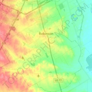
Name: Robinson topographic map, elevation, terrain.

Location: Robinson, McLennan County, Texas, United States (31.39918 -97.17746 31.50700 -97.06602)

Average elevation: 476 ft

Minimum elevation: 364 ft

Maximum elevation: 627 ft

Other topographic maps

Click on a map to view its topography, its elevation and its terrain.

Elm Mott

United States > Texas > McLennan County

Average elevation: 512 ft

Bruceville-Eddy

United States > Texas > McLennan County

Average elevation: 650 ft

Hewitt

United States > Texas > McLennan County > Hewitt > Hewitt

Average elevation: 620 ft

Waco

United States > Texas > McLennan County > Waco

Average elevation: 492 ft

Gear up for your next adventure:

🧦Hiking Socks - Comfortable socks to prevent blisters on long hikes
🥤Water Filter Bottle - All‑in‑one filter bottle for safe hydration
🔥Camping Stove - Portable stove for camping and backcountry cooking
☀️Outdoor Sunscreen - High protection sunscreen for outdoor activities
🖼️Topo Map Wall Art - Decorative topographic prints of famous peaks and regions

As an Amazon Associate, this site earns from qualifying purchases at no extra cost to you.