
Thank you for supporting this site ❤️
Make a donation
Make a donation
Gear up for your next adventure:
As an Amazon Associate, this site earns from qualifying purchases at no extra cost to you.
Sake topographic map
Click on the map to display elevation.
Thank you for supporting this site ❤️
Make a donation
Make a donation
Gear up for your next adventure:
As an Amazon Associate, this site earns from qualifying purchases at no extra cost to you.
About this map
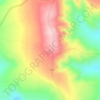
Name: Sake topographic map, elevation, terrain.
Location: Sake, Ngoma District, Eastern Province, Rwanda (-2.23280 30.41782 -2.23270 30.41792)
Average elevation: 4,820 ft
Minimum elevation: 4,373 ft
Maximum elevation: 5,187 ft
Thank you for supporting this site ❤️
Make a donation
Make a donation
Gear up for your next adventure:
As an Amazon Associate, this site earns from qualifying purchases at no extra cost to you.