
Blue Lake topographic map
Click on the map to display elevation.
Blue Lake
Each November, the lake turns to a deep turquoise colour, gradually returning to a duller blue colour in late February to March. The exact cause of this phenomenon is still a matter of conjecture, but likely it involves the warming of the surface layers of the lake during the summer to around 20 °C (68 °F), causing calcium carbonate to precipitate out of the solution and enabling microcrystallites of calcium carbonate to form. This results in scatter of the blue wavelengths of sunlight. During winter, the lake becomes well mixed, and recent research indicates that during this phase of the colour cycle, the lake is somewhat murkier due to the redistribution of tannins and calcium carbonate particles throughout the lake. Solar elevation has also been found to influence the perceived colour of the lake. The movement of planktonic life forms within the lake during the seasons and during the day may additionally play a part in the colour change.
About this map
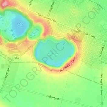
Name: Blue Lake topographic map, elevation, terrain.
Average elevation: 174 ft
Minimum elevation: 0 ft
Maximum elevation: 407 ft