
Thank you for supporting this site ❤️
Make a donation
Make a donation
Gear up for your next adventure:
As an Amazon Associate, this site earns from qualifying purchases at no extra cost to you.
Petangis topographic map
Click on the map to display elevation.
Thank you for supporting this site ❤️
Make a donation
Make a donation
Gear up for your next adventure:
As an Amazon Associate, this site earns from qualifying purchases at no extra cost to you.
About this map
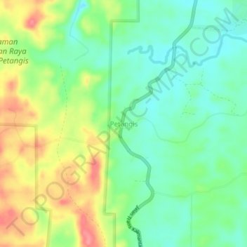
Name: Petangis topographic map, elevation, terrain.
Location: Petangis, Paser, East Kalimantan, Kalimantan, Indonesia (-2.12974 116.08310 -2.08974 116.12310)
Average elevation: 112 ft
Minimum elevation: 3 ft
Maximum elevation: 282 ft
Thank you for supporting this site ❤️
Make a donation
Make a donation
Gear up for your next adventure:
As an Amazon Associate, this site earns from qualifying purchases at no extra cost to you.