
Make a donation
Gear up for your next adventure:
As an Amazon Associate, this site earns from qualifying purchases at no extra cost to you.
Mangowal topographic map
Click on the map to display elevation.
Make a donation
Gear up for your next adventure:
As an Amazon Associate, this site earns from qualifying purchases at no extra cost to you.
About this map
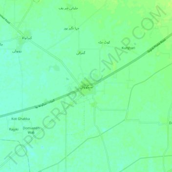
Name: Mangowal topographic map, elevation, terrain.
Average elevation: 725 ft
Minimum elevation: 709 ft
Maximum elevation: 745 ft
Make a donation
Gear up for your next adventure:
As an Amazon Associate, this site earns from qualifying purchases at no extra cost to you.
Other topographic maps
Click on a map to view its topography, its elevation and its terrain.
Lalamusa
Pakistan > Punjab > Gujrat District
Lalamusa is situated on the Grand Trunk Road (National Highway 5). It is geographically located at latitude (32.7 degrees) 32° 42' 0" North of the Equator and longitude (73.96 degrees) 73° 57' 35" East of the Prime Meridian on the Map of the world and lies at an altitude of about 250 meters.
Average elevation: 833 ft