Geolocate

Haddington topographic map

Click on the map to display elevation.

About this map

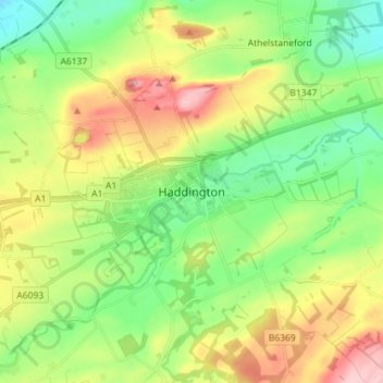
Name: Haddington topographic map, elevation, terrain.

Location: Haddington, East Lothian, Scotland, EH41 3JA, United Kingdom (55.91561 -2.81932 55.99561 -2.73932)

Average elevation: 256 ft

Minimum elevation: 43 ft

Maximum elevation: 607 ft

Gear up for your next adventure:

👖Convertible Hiking Pants - Versatile zip-off pants for changing altitudes and temperatures
🏕️Tent Footprint - Protect your tent base from wear
🪶Trail Camera - Capture wildlife on your hikes
🪶Compact Camp Shovel - Folding shovel for campsite tasks
🪶Paracord Bracelet - Survival bracelet with built‑in tools

As an Amazon Associate, this site earns from qualifying purchases at no extra cost to you.