
Vorkuta topographic map
Interactive map
Click on the map to display elevation.
About this map
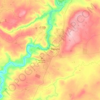
Name: Vorkuta topographic map, elevation, terrain.
Average elevation: 577 ft
Minimum elevation: 322 ft
Maximum elevation: 797 ft
Other topographic maps
Click on a map to view its topography, its elevation and its terrain.
Severny
Russia > Komi Republic > Vorkuta Urban Okrug > Severny
Severny, Vorkuta Urban Okrug, Komi Republic, Northwestern Federal District, Russia
Average elevation: 522 ft