
Thank you for supporting this site ❤️
Make a donation
Make a donation
Gear up for your next adventure:
As an Amazon Associate, this site earns from qualifying purchases at no extra cost to you.
Petit-Enghien topographic map
Click on the map to display elevation.
Thank you for supporting this site ❤️
Make a donation
Make a donation
Gear up for your next adventure:
As an Amazon Associate, this site earns from qualifying purchases at no extra cost to you.
About this map
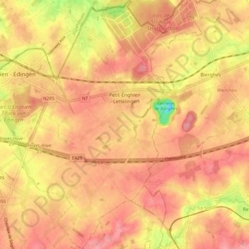
Name: Petit-Enghien topographic map, elevation, terrain.
Location: Petit-Enghien, Enghien, Ath, Hainaut, Wallonia, Belgium (50.65350 4.03724 50.71351 4.11410)
Average elevation: 217 ft
Minimum elevation: 13 ft
Maximum elevation: 305 ft
Thank you for supporting this site ❤️
Make a donation
Make a donation
Gear up for your next adventure:
As an Amazon Associate, this site earns from qualifying purchases at no extra cost to you.