Geolocate

Bugallon topographic map

Click on the map to display elevation.

About this map

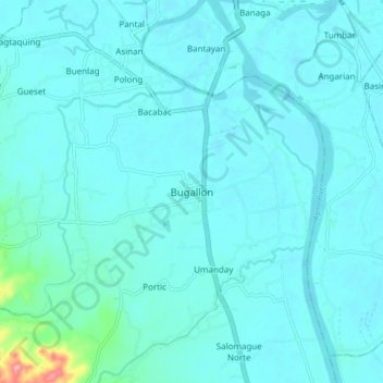
Name: Bugallon topographic map, elevation, terrain.

Location: Bugallon, Pangasinan, Ilocos Region, 2416, Philippines (15.91406 120.17496 15.99406 120.25496)

Average elevation: 36 ft

Minimum elevation: 0 ft

Maximum elevation: 390 ft

Gear up for your next adventure:

🏫Relief Map Kits - Hands-on tools for teaching landforms and elevation
🧭Map Reading Tools - Tools and kits for map navigation
🪵Folding Camp Saw - Compact saw for wood and campsite work
GPS Sports Watch - GPS watch for running, hiking and training
📱Heavy-Duty Phone Cases - Drop-proof and waterproof protection for outdoor navigation

As an Amazon Associate, this site earns from qualifying purchases at no extra cost to you.