Geolocate

Cabetican topographic map

Click on the map to display elevation.

About this map

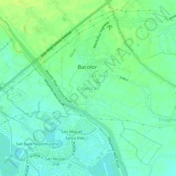
Name: Cabetican topographic map, elevation, terrain.

Location: Cabetican, Pampanga, Central Luzon, 2001, Philippines (14.97172 120.63159 15.01172 120.67159)

Average elevation: 23 ft

Minimum elevation: -7 ft

Maximum elevation: 52 ft

Gear up for your next adventure:

🔊Portable Camp Speaker - Music and alerts at camp
🪶Survival Guide Book - Expert advice for emergency preparedness
🦟Ultrasonic Repellers - Create a bug-free zone at your camp or rest stop
🗃️Trail First Aid Kit - Essential kit for outdoor injuries and emergencies
🪶Camping Sleeping Pad - Comfortable sleeping pad for backpacking

As an Amazon Associate, this site earns from qualifying purchases at no extra cost to you.