
Make a donation
Gear up for your next adventure:
As an Amazon Associate, this site earns from qualifying purchases at no extra cost to you.
Tal Afar topographic map
Click on the map to display elevation.
Make a donation
Gear up for your next adventure:
As an Amazon Associate, this site earns from qualifying purchases at no extra cost to you.
About this map
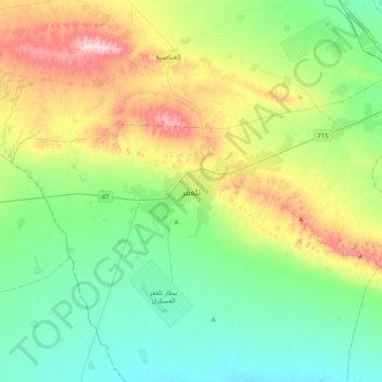
Name: Tal Afar topographic map, elevation, terrain.
Average elevation: 1,243 ft
Minimum elevation: 886 ft
Maximum elevation: 2,090 ft
Make a donation
Gear up for your next adventure:
As an Amazon Associate, this site earns from qualifying purchases at no extra cost to you.
Other topographic maps
Click on a map to view its topography, its elevation and its terrain.
Nimrud
Iraq > Nineveh Governorate > Qaryat an Namaniyah
Subsequent work was by the Directorate of Antiquities of the Republic of Iraq (1956, 1959–60, 1969–78 and 1982–92), the Polish Centre of Mediterranean Archaeology University of Warsaw directed by Janusz Meuszyński (1974–76), Paolo Fiorina (1987–89) with the Centro Ricerche Archeologiche e Scavi di…
Average elevation: 666 ft
Make a donation
Gear up for your next adventure:
As an Amazon Associate, this site earns from qualifying purchases at no extra cost to you.