Geolocate

Nebo topographic map

Click on the map to display elevation.

About this map

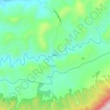
Name: Nebo topographic map, elevation, terrain.

Location: Nebo, Smyth County, Virginia, 24318, United States (36.92178 -81.46178 36.96178 -81.42178)

Average elevation: 2,530 ft

Minimum elevation: 2,077 ft

Maximum elevation: 3,615 ft

Smyth County trails, hiking, mountain biking, running and outdoor activities

Gear up for your next adventure:

🎒Waterproof Dry Bags - Keep your electronics and maps dry inside your pack
🧯Emergency Survival Kit - All‑in‑one survival essentials for the backcountry
🦺Reflective Outdoor Gear - Safety gear for low‑light conditions
🏕️Family Camping Gear - Essentials for group camping trips
🎒Trail Energy Bars - High‑calorie bars for hiking energy

As an Amazon Associate, this site earns from qualifying purchases at no extra cost to you.