Geolocate

Lico topographic map

Click on the map to display elevation.

About this map
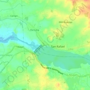
Name: Lico topographic map, elevation, terrain.

Location: Lico, San Rafael, Bulacan, Central Luzon, 3007, Philippines (14.93870 120.93775 14.97870 120.97775)

Average elevation: 85 ft

Minimum elevation: 26 ft

Maximum elevation: 164 ft

Other topographic maps

Click on a map to view its topography, its elevation and its terrain.

Bustos Dam

Philippines > Bulacan > San Rafael > Lico

Average elevation: 79 ft

Gear up for your next adventure:

🥘Titanium Cookware - Durable, featherlight pots and pans for backpacking
🔦Compact Flashlight - Reliable flashlight for emergencies
🚁Photography Drones - Capture stunning aerial views of landforms and topography
🪄Magnetic Compass - Accurate compass for navigation
🥾Men's Hiking Boots - Durable, waterproof footwear for rugged terrain and steep inclines

As an Amazon Associate, this site earns from qualifying purchases at no extra cost to you.